12 of The Best Valley of Fire State Park Hikes
Valley of Fire is often overlooked compared to Utah’s Mighty Five or Red Rock Canyon, but if you’re in Vegas or doing a Mighty Five road trip, you need to check it out.
This oldest state park in Nevada might not be as famous, but that’s what makes it special: it’s less crowded, underrated, and absolutely stunning.
It was our last stop on a 10-day Utah RV trip because it was close to Vegas, but it ended up being one of our favorite stops.
The views are otherworldly, with a scenic drive, and the hikes are easy to moderate, yet you’re constantly surrounded by beautiful landscapes.
If you’re ready to visit, this guide will share some of the best Valley of Fire State Park hikes, where to camp, what to pack, and more.
Tips for Hiking in Valley of Fire State Park
- Entrance Fee: Valley of Fire State Park has an entrance fee of $10 per vehicle for Nevada residents and $15 per vehicle for non-residents. It is not covered by the federal America the Beautiful Pass.
- Water: Carry at least one gallon (4 liters) of water per person per day. The last water refill is at the visitor center.
- Best Time To Visit: Fall through spring (October to April) provides milder temperatures. Summer gets really hot in the park, and hiking is even prohibited in many areas from mid-May through the end of September.
- Time of Day: If possible, visit during the early mornings or late afternoons to avoid midday heat and to capture the park’s golden hues.
- Clothing and Sun Protection: Wear light, moisture-wicking fabrics. Long sleeves and pants can protect against the sun and brush. Pack sunscreen, a wide-brimmed hat, and sunglasses to shield against UV rays.
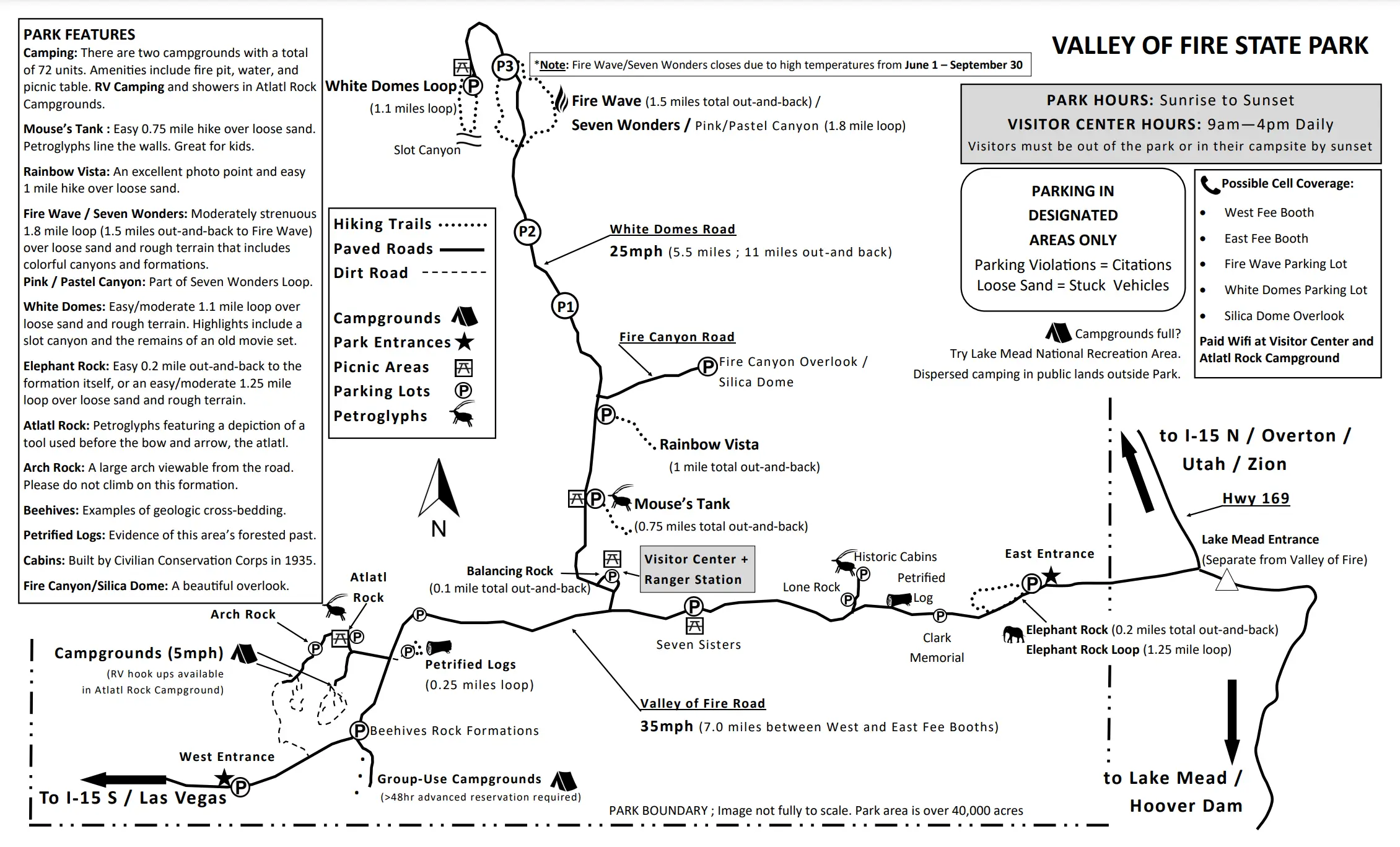
- Trail Markings: Some trails may have limited signage. Get a map from the visitor center or save an offline map from AllTrails.
- Leave No Trace: Pack out all trash, stay on designated trails, and avoid disturbing wildlife.
- Camping: There a two campgrounds in Valley of Fire. One is at Atlatl Rock and another is for group use near the Beehives Rock Formation. It offers full hookups, potable water, a dumpsite, a fire pit, and picnic tables. Reserve in advance at ReserveNevada.com. If you’re looking for free dispersed camping nearby the park, we camped here.
🤩 Planning to hike Valley of Fire?
It’s one of the most stunning places I’ve ever seen—but it’s also remote, hot, and rugged. One wrong step or heat headache can turn your desert dream into an expensive detour.
I use SafetyWing every time I travel in the U.S., especially when hiking state and national parks like this. Get covered before you hit the trail.
Valley of Fire Best Hikes
1. Fire Wave, White Domes, and Seven Wonders Loop
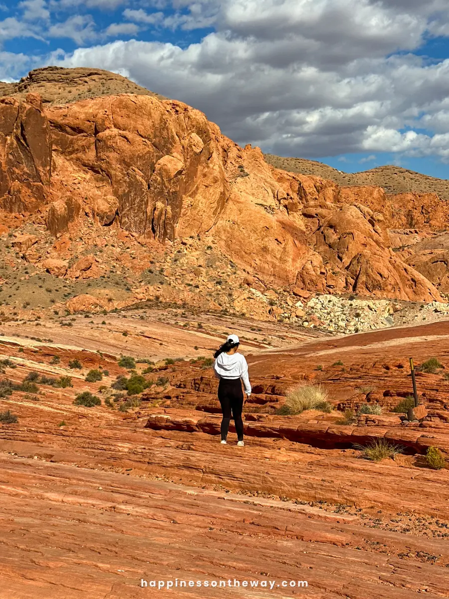
This is my absolute favorite hike in Valley of Fire. If you have time for just one hike, and you’re up for something moderately challenging, this is the one.
This hike combines some of the most iconic features—the surreal Fire Wave, the White Domes that look like they’ve been sculpted by an artist, and the unique formations of the Seven Wonders.
This trail showcases a little bit of everything that makes Valley of Fire so spectacular: rock formations, slot canyons, and epic colors.
- Distance: 3.1 miles (5.1 kilometers)
- Level: Moderate
- Time: 2-3 hours
- Starting Point: Fire Wave Trailhead P3 Parking
- Route Map via Alltrails
This trail is closed annually from May 15 to September 30.
2. Fire Wave and Seven Wonders Loop
If you’re short on time or just want a lighter version of the above, there’s a shorter loop that still covers the Fire Wave and Seven Wonders.
You can either start from the Fire Wave trailhead or Seven Wonders Trailhead. The formations seem to dance in shades of orange, red, and even pink and a lot brighter during sunset.
- Distance: 1.9 miles (3.1 kilometers)
- Level: Moderate
- Time: 1.5-2 hours
- Starting Point: P3 Parking
- Route Map via Alltrails
This trail is closed annually from May 15 to September 30.
3. Seven Wonders Trail
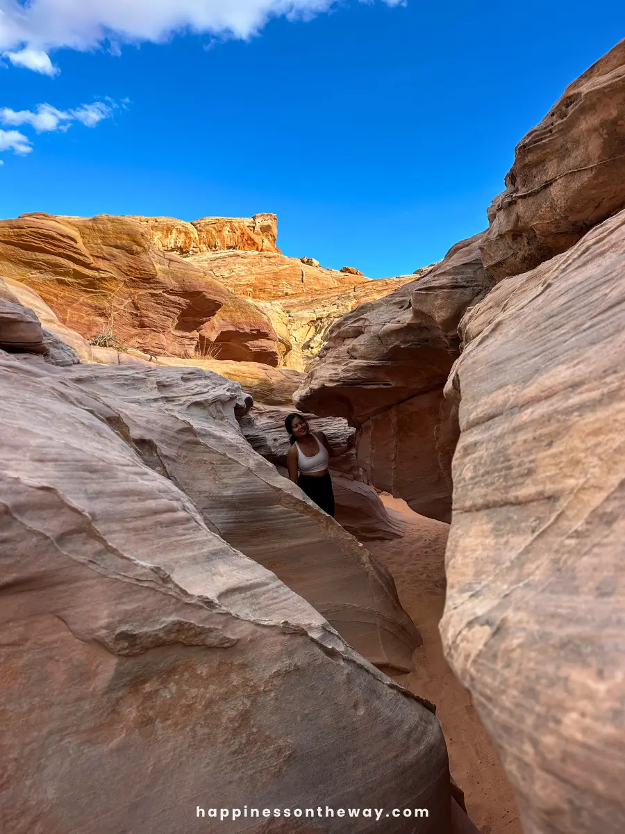
While the Fire Wave Trail is the most famous in Valley of Fire, I honestly think the Seven Wonders Trail has the edge when it comes to diversity of views and smaller crowds. There’s even a small rock hill that looks like the Fire Wave, with gradients of yellow.
If you’re wondering what the seven wonders are—like I was—they are the Fire Wave, Kaolin Slot Canyon, Crazy Hill, Fire Cave, Striped Rock, Thunderstorm Arch, and Pastel Pink Canyon. It’s like a sampler of all the best features of the park, wrapped up in one hike.
These seven wonders are not marked, but you’ll see metal signs with yellow trail markers to follow along. It’s easy to get lost on this trail, so I recommend having an offline AllTrails map with you.
- Distance: 1.8 miles (2.9 kilometers)
- Level: Easy to Moderate
- Time: 1.5 hours
- Starting Point: P3 Parking
This trail is closed annually from May 15 to September 30.
4. Fire Wave Trail
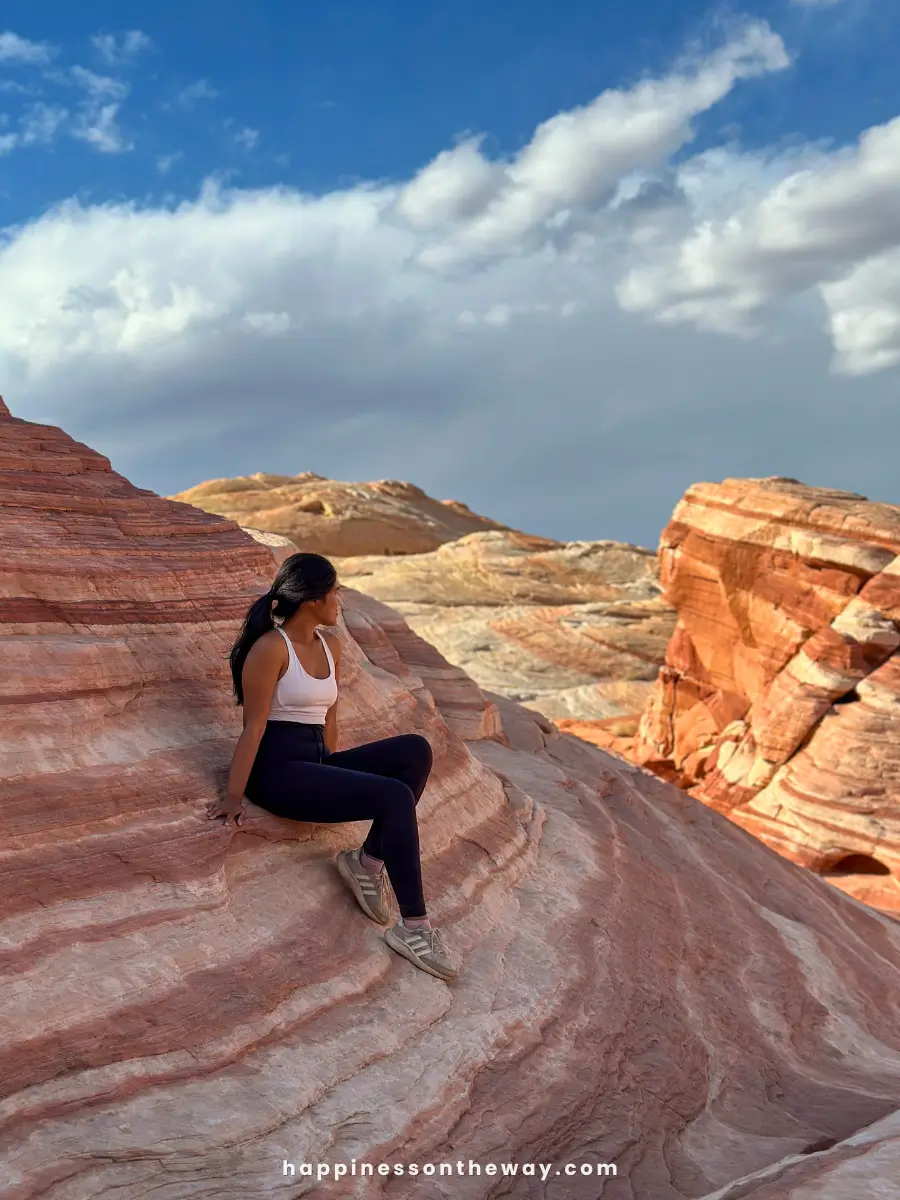
If you’ve ever seen a photo of Valley of Fire, chances are you were looking at the Fire Wave Trail. It’s the most famous among the Valley of Fire hikes, and I’d still recommend visiting at least once.
It’s a short and relatively easy hike, and even though it’s quite popular, it doesn’t get too crowded.
You’ll get to experience the undulating layers of red and white sandstone, with formations that genuinely look like frozen waves. It’s best to do this hike around sunrise or sunset for extra dramatic colors.
- Distance: 1.5 miles (2.4 kilometers)
- Level: Easy
- Time: 1 hour
- Starting Point: P3 Parking
- Route Map via Alltrails
This trail is closed annually from May 15 to September 30.
5. White Domes Trail
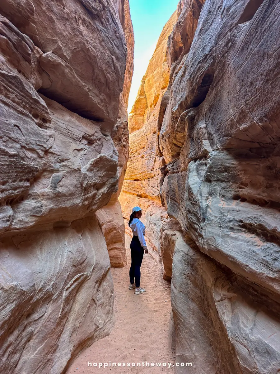
The White Domes Trail features prominent white sandstone formations that starkly contrast with the vibrant red sandstone Valley of Fire is known for.
The hike starts with a descent into the valley, giving you a great view right from the beginning. My favorite part is winding through a short slot canyon and being surprised by the way the light hits the slot’s opening.
The trail is a loop, so you’ll see different formations, colors, and views from start to finish.
- Distance: 1.1 miles (1.8 kilometers)
- Level: Easy
- Time: 45 minutes to 1 hour
- Starting Point: White Domes Traihead Parking
- Route Map via Alltrails
This trail is closed from May 15 to September 30.
6. Prospect Trail
The Prospect Trail is the longest hiking trail in Valley of Fire. It connects the park’s western entrance near Atlatl Rock to the White Domes Loop at the end of Mouse’s Tank Scenic Drive.
This trail offers the widest variety of rock formations and colors in the park, from the 200-million-year-old red Aztec sandstone to the striking red and white stripes.
It’s a challenging hike, with some steep areas and lots of loose gravel, but since it’s one of the lesser-known hikes in Valley of Fire, you’ll mostly have all the views to yourself.
- Distance: 11 miles (18 kilometers)
- Level: Difficult
- Time: 6-7 hours
- Starting Point: Prospect Trailhead near Western Entrance
- Route Map via Alltrails
This trail is closed annually from May 15 to September 30.
7. Petroglyph Canyon via Mouse’s Tank Trail
Mouse’s Tank Trail is short and easy, but it’s packed with fascinating prehistoric petroglyphs carved into the red sandstone walls, mostly on the left side as you walk through.
These carvings, believed to be from the Basketmaker culture around 2,500 years ago, show all kinds of symbols, animals, and human figures.
The canyon itself is beautiful, but the petroglyphs are what truly make this trail stand out. The trail gets its name from an outlaw nicknamed “Mouse,” who used the area as a hideout in the late 1800s.
At the end of the trail, you’ll find Mouse’s Tank, a natural water basin that often has water in it.
This is a perfect hike if you’re looking for something easy, educational, and family-friendly.
- Distance: 0.75 miles (1.2 kilometers)
- Level: Easy
- Time: 30-45 minutes
- Starting Point: Mouse’s Tank Parking
- Route Map via AllTrails
8. Rainbow Vista Trail
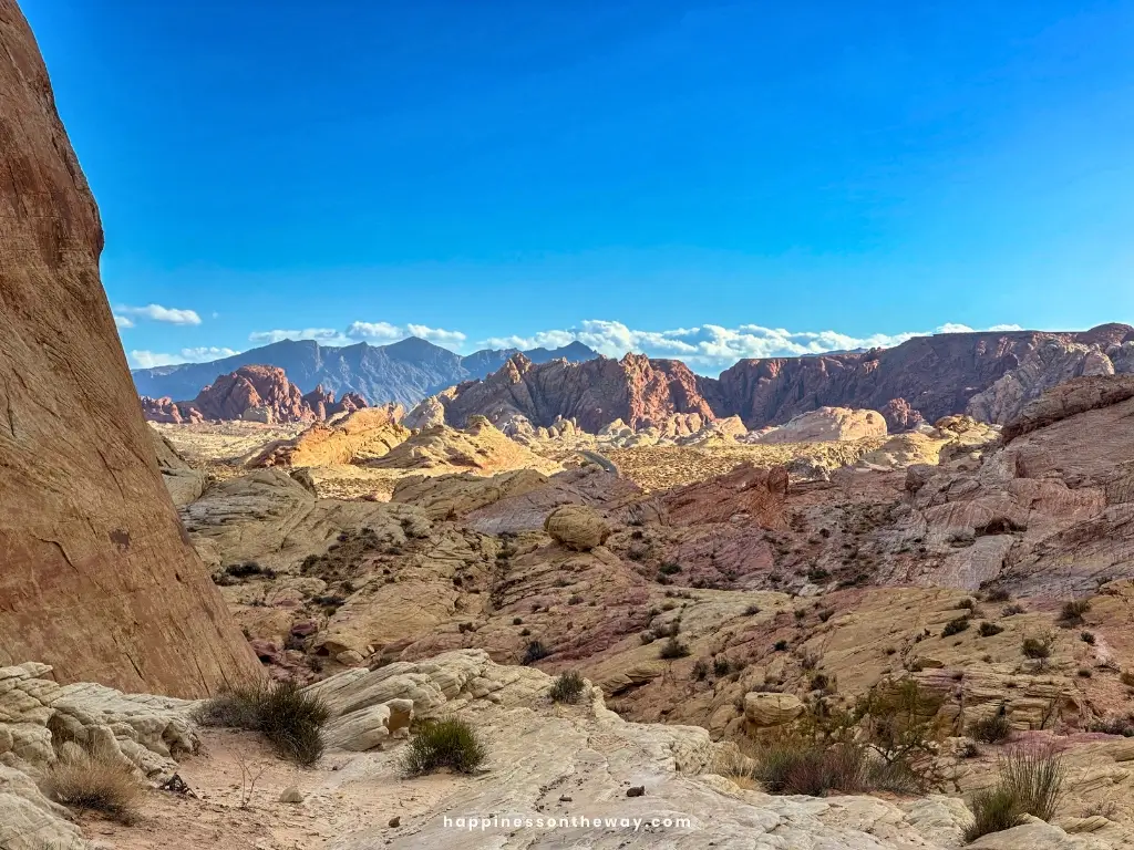
Rainbow Vista shows just how colorful the desert can be. The trail takes you through an open valley surrounded by red, pink, yellow, and purple rock layers.
It’s fairly easy, and at the end, you’ll reach a beautiful panoramic view of Fire Canyon, known for its fiery red rock formations.
This hike is especially stunning in the late afternoon when the colors become even more vivid.
PRO TIP: Across from the Rainbow Vista parking lot, you’ll find the iconic Instagram spot with the road framed by mountains in the background. Just head down on the opposite side and climb one of the rocks for the perfect shot.
- Distance: 1 mile (1.6 kilometers)
- Level: Easy
- Time: 45 minutes to 1 hour
- Starting Point: Rainbow Vista Parking
- Map Route via AllTrails
9. Elephant Rock Trail
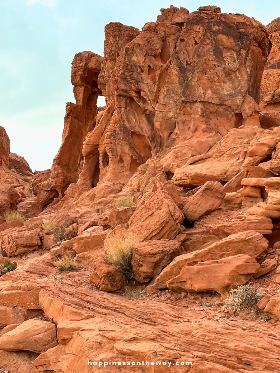
If you’re spending a full day at Valley of Fire, you can drive to the Elephant Rock Trail and spot the fun, elephant-shaped rock formation.
It might take a bit of imagination to see the shape, but it’s definitely a unique sight. The hike is easy and can be done in two ways: a short 0.2-mile walk north from the nearby parking lot or a longer 1.25-mile loop that takes you around other rock formations.
It’s also close to the east entrance, where you’ll find a charming “Greetings from the Valley of Fire State Park” photo frame.
If you only have half a day, I’d recommend skipping this one.
- Distance: 0.2 or 1.2 miles (0.35 to 1.9 kilometers)
- Level: Easy
- Time: 15-45 minutes
- Starting Point: East Entrance
- Map Route via AllTrails
10. Atlatl Rock Viewpoint
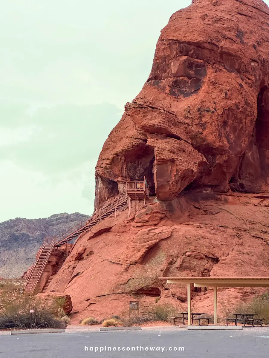
This isn’t really a hike, but it’s definitely worth a stop. You’ll climb a metal staircase, approximately 0.1 miles, to reach Atlatl Rock, where you can see some of the best petroglyphs in the park.
The carvings are attributed to the Ancestral Puebloans, date back over 2,000 years, and give you a glimpse into the ancient cultures that once lived in this area. The viewpoint also offers a great panoramic view of the valley.
It’s worth a stop if you’re camping at the Atlatl campground. If you’re coming with an RV, there’s a nearby free dump station and potable water refilling station.
- Distance: 0.1 mile (0.16 kilometers)
- Level: Easy
- Time: 15-20 minutes
- Starting Point: Atlatl Parking near the West Entrance
11. Pinnacles Trail Loop
The Pinnacles Trail Loop is another fantastic trail to escape the crowds and explore a quieter part of the park.
This hike takes you through rocky terrain with plenty of unique rock spires and formations along the way. It’s a moderately challenging hike, mostly because of its length, but it’s well worth it for the views and the peaceful surroundings.
Due to low foot traffic, there’s a higher chance of spotting wildlife here, such as the desert bighorn sheep, which is commonly found in Valley of Fire State Park.
- Distance: 4.5 miles (7.2 kilometers)
- Level: Moderate
- Time: 2-3 hours
- Starting Point: Atlatl Rock Parking
- Map Route via Alltrails
This trail is closed annually from May 15 to September 30.
12. Pastel Pink Canyon Trail
Pastel Pink Canyon, also called Pink Canyon, is one of the most beautiful Valley of Fire Hikes. The canyon’s walls are soft pink, almost like a watercolor painting.
It’s an unmarked trail. You can find the canyon on the southeast section of the Seven Wonders Loop.
- Distance: 1.2 miles (1.9 kilometers)
- Level: Easy
- Time: 1 hour
- Starting Point: P3 Parking
This trail is closed annually from May 15 to September 30.
FAQs: Hiking in Valley of Fire
What is the most scenic hike in Valley of Fire?
The Seven Wonders Trail is hands down the most scenic hike in Valley of Fire. It takes you through iconic spots like the Fire Wave, Pink Canyon, and Crazy Hill.
You’ll see incredible colors and cool rock formations, and it’s not as crowded as the Fire Wave Trail. If you have the time and energy, I’d recommend doing the loop that includes the Fire Wave and White Domes.
How much time do you need at Valley of Fire State Park?
A full day will allow you to do a big hike or a couple of shorter ones, plus take a scenic drive around the park. But even if you’ve only got half a day (3-4 hours), it’s still worth it.
You can take a scenic drive, stop at some viewpoints, and do one easy or moderate trail.
What time of day is best for Valley of Fire?
Early morning or late afternoon is the best time to visit. The temperatures are cooler, and the light brings golden tones that make the red rocks glow.
Midday can get extremely hot, especially in the summer, I would avoid it if possible.
What to wear in Valley of Fire?
Wear lightweight, breathable clothes because it can get hot out there. Wear hiking shoes and pack a hat, sunglasses, and plenty of sunscreen—the sun can be brutal.
What is the difference between Red Rock Canyon and Valley of Fire?
Rock Canyon is closer to Las Vegas (approximately 17 miles) and is great for hiking and rock climbing. Valley of Fire is about an hour away, feels more remote, and has those dramatic red rock formations and petroglyphs.
Wrap-Up: Valley of Fire State Park Hikes
Valley of Fire State Park has some of the best, underrated hiking trails in the Southwest. Whether you’re adding it to your Mighty Five road trip or looking for an easy day trip from Las Vegas, it’s worth taking the time to explore these incredible landscapes. You definitely won’t regret it!
Which did you end up hiking among these Valley of Fire hikes? How was the experience?


